SBTF & USAID Partnership on Poverty Alleviation and Smarter Development

The Standby Volunteer Task Force (SBTF) continues to break new ground in. This time around we’re partnering with colleagues at the US Agency for International Development (USAID) who recognize, like we do, that equitable and sustainable economic growth is instrumental for countering extreme poverty across the globe. Being one of the biggest development organizations in the world, USAID has the resources to have significant impact on the livelihoods of millions. To this end, our colleagues want to better understand the link between their economic growth initiatives and their subsequent impact on poverty alleviation. This is where we as SBTF volunteers come in.

Our partners have access to a considerable amount of data which, if analyzed, will yield some very important empirical  insights on the link between economic growth projects and poverty alleviation. The challenge, simply put, is to geo-code these datasets so that we can all better understand the geographic impact of various local economic initiatives vis-a-vis extreme poverty. Geo-code simply means finding the geographic location of said projects so that the resulting data can be mapped. USAID has already used automated methods to do this, but some datasets can only be processed by humans. But why map this data in the first place? Because maps can reveal powerful new insights that can catalyze new areas of potential collaboration with host countries, researchers, other development organizations and the public.

The local economic growth projects in question are aimed at reducing poverty and thereby changing people’s lives for the better. The results of the analysis, all of which shall be made public, will be used directly by USAID to fine tune their programs and thus increase their impact on poverty alleviation; welcome to Smarter Development! Given the extraordinary commitment of SBTF volunteers in projects past, our USAID colleagues have approached us to help them geo-code these important datasets. This is the very first time that USAID has reached out to online volunteer communities to actively help them process data about their organization’s impact in the field.

The result of this partnership will be a unique geo-coded dataset and a case study of said dataset that will be completely public for anyone to review. We’re excited to be partners in this effort since the project will demonstrate how crowdsourcing and online volunteers can play a significant role in both opening up development data and analyzing said data for the purposes of Smarter Development. This project will also provide SBTF volunteers with the opportunity to develop new skills while refining their existing skills and learning about how to work with new technologies.

Onwards!

Posted in Uncategorized | Tagged , , , , | 5 Comments

Resources for Online Anonymity, Encryption, and Privacy

Reposted from the Herdict Blog of the Berkman Center for Internet and Society

Please, remember security is never perfect, but we can make best effort and always be informed.

Resources for Online Anonymity, Encryption, and Privacy

By Alex Meriwether | May 7th | 

There are many tools available to help Internet users reach the content they seek more securely, safely, anonymously, and reliably. But the thicket of acronyms and technological terms can be intimidating to many people. What’s a VPN? How is that different than a proxy? Does “private browsing” stop my ISP from looking at my data? The complexity can cause people to throw up their hands and do nothing.

We put together this primer because inaction born out of confusion is the worst outcome. In the cat-and-mouse game against censors and snoops, there are many tools that can help, but they do very different things and they aren’t perfect. Although, there is no wholly foolproof and undetectable manner of anonymous, encrypted, private browsing, the resources we describe below are better than nothing.

Below we will map out the basics of several options available to users—including proxies, VPNs, and Tor—as well as future emerging technologies like Telex. This is meant to be an introduction to the types of tools that are available, as well as an introduction to the limitations and risks of each. We have not tested all of them, so as always, do your own research before trusting a third party with your data.


“Private Browsing” Mode in Web Browsers

How It Works: All of the major web browsers offer a “Private Browsing” function. When this function is activated, everything that the browser usually stores on the local computer—browser history, caches, cookies, download lists, form data, passwords, and other temporary files—is deleted when the browser is closed or the function is turned off. Private browsing limits what files are saved to your system so that it is more difficult for someone with physical access to your computer to trace your steps. It also makes it harder for sites to track you because their cookies are deleted.

Limitations: People mistakenly believe that “private browsing” anonymizes them to the websites they visit and makes their communications private. Unfortunately, that’s not true. Even with private browsing mode on, anyone intercepting or handling your traffic can see what you’re doing. For instance, ISPs can still record what sites you visit. And if you log into a site like Gmail, Google will still be able to associate all your actions on the site with your username, even if private browsing is enabled. Moreover, private browsing may not even stop sites from tracking you. A Stanford study determined that some sites can both determine information about visitors as well as leave behind traces on users’ systems. For instance, plug-ins installed in the browser can still track users through an independent system of cookies and temporary files. Thus, private browsing only protects you against someone who is using your computer and snooping through your browsing history. And someone with that kind of access to your computer could install a keylogger or other hidden program that records your keystrokes. Despite these limitations, private browsing can be a helpful way of reducing the amount of information that is recorded on your computer when browsing.

Resources:

Your Guide to Private Browsing | HuffPost Tech: menu commands and keyboard shortcuts to launch a private browsing session in IE, Firefox, Chrome, Safari, and Opera.
Private Browsing: Activating Private Browsing Mode in Your Favorite Browser | About: graphic tutorials on launching private browsing sessions in IE, Firefox, Chrome, Safari, Opera, and Flock; tips for private browsing on iPad, iPhone, and iPod touch.


Secure Browsing (through HTTPS)

How It Works: HTTPS is a way for users to protect the content of their communications from eavesdropping. When browsers don’t use HTTPS and transmit data openly, anyone along the path between the browser and the destination can view what is transmitted (that includes the ISPs that carry your traffic, or individuals surreptitiously intercepting the data). By encrypting the data, you make it much harder for anyone other than the intended recipient to see the content. Most major sites that require you to log-in (Google, Facebook, Twitter) and sites that transfer sensitive information (banking sites) now offer an encrypted connection. (Instead of http://www.google.com, your address bar will read https://www.google.com).

Limitations: Many sites don’t offer HTTPS, and some that do default to unencrypted HTTP or go back to unencrypted pages after the log-in process. Because of that, users must keep an eye on when they are encrypted and when they are not. Using a resource like HTTPS Everywhere can at least ensure that you connect using HTTPS for those sites that have that option. It’s important to remember that even if you connect to a site like Gmail using HTTPS, you are not hiding the destination only the content; an ISP or a government can still know you’re visiting Gmail. HTTPS is also not foolproof, as it is possible for a determined party to pretend to be the destination, in what is a called a man-in-the-middle attack.

Resources:

HTTPS Everywhere is a Firefox and Chrome extension from the Electronic Frontier Foundation. It will automatically switch sites from HTTP to HTTPS whenever possible and warn users about web security holes.


Circumvention & Anonymity

Among the greatest threats to Internet freedom are filtering and surveillance. These related issues either prevent you from accessing the content you want or allow third parties to keep track of what content you do access, respectively. Many of the tools to evade one also help with the other, so we discuss them together below. In most cases, these tools will help disguise your IP address, the sites you’ve visited, and technical information about your device, while possibly helping you access censored content.

Proxy Servers

How They Work: A proxy server is a machine that stands as an intermediary between your machine and the content you are trying to reach. Proxies can help evade censorship or filtering when connections to the proxy aren’t filtered but the desired content is. When you connect to censored content through a proxy, the censor will see only your connection to the proxy, not the verbotten content. Proxies also provide some anonymity because to the destination server, you look like you’re coming from the proxy server, not your actual origin. Web-based proxies are the easiest way to use a proxy server. Simply visit a proxy website with your prefered browser, enter your target URL, and the proxy site will then relay the request and deliver the site content back to you. There are also a number of downloadable clients for both Mac and Windows that connect your system to a proxy server.

Limitations: There are several downsides to using proxies, ranging from annoyances to serious security threats. On the annoyance side, because your data is passing through a single, fixed (and likely overloaded) point, it is not uncommon to experience slow load times and connection errors. On the security side, because all of your data is passing through a single, fixed point, it is easy for nefarious individuals to intercept any unencrypted data (using HTTPS or VPNs in addition to a proxy may address these concerns, but they have their own limitations described elsewhere in this post). In fact, sometimes hackers set up proxies with the express purpose of collecting user details, so it is important to carefully choose a trusted proxy. Using proxies can often be a game of cat and mouse; countries that filter sites often block known proxies, forcing users to move to a new, lesser known proxy. In some cases these same governments may create proxies specifically so they can monitor all the traffic and identify users.

Resources
Regularly updated lists of web-based proxies:
  • Tech-FAQ’s  (via CNET)
  • Public Proxy Servers (via Open Security Research)
  • Circumventor Central (via Open Security Research)
Web-based proxies (via Techlicious):
  • Anonymouse
  • HideMyAss
Downloadable proxy clients:
  • Alkasir (Windows – English, Arabic) Learn more about Alkasir.
  • Freegate (Windows – English, Chinese, Persian, Spanish) Learn more about Freegate.
  • JonDo (Mac, Windows, Ubuntu, Linux, Android – English, German, Czech, Dutch, French, Russian) Learn moreabout JonDo.
  • proXPN (Mac, Windows, and iPhone – English)
  • Psiphon (Various configurations, including a lightweight web proxy that runs on Windows and Linux plus a cloud-based solution) Learn more about Psiphon.
  • SabzProxy (Mac, Windows, Linux – Persian) Learn more about SabzProxy.
  • Simurgh (Windows – English) Learn more about Simurgh.
  • Ultrasurf (Windows – English) Learn more about UltraSurf. Also note Tor’s recent report detailing Ultrasurf security holes and Ultrasurf’s response.
  • Your-Freedom (Mac, Windows, Linux – 20 languages) Learn more about Your-Freedom.


VPNs

How They Work: Like proxy servers, Virtual Private Networks (VPNs) route users’ traffic through their own servers. What makes VPNs different from a standard open proxy is that VPNs authenticate their users and encrypt data. Additionally, because of how VPNs are configured, they are more likely to work with software on your computer that you use for email, instant messaging, and “Voice over IP” (VoIP).

Limitations: VPNs share some of the same risks as proxy servers. Because all of your traffic is passing through a single point, your security is only as good as that of your VPN. Some VPN services keep traffic logs, and free services in particular may be disposed to sell your information to advertisers or turn it over under pressure from authorities. Free ad-supported VPNs may limit your bandwidth; paid VPN services are generally more reliable and come with a much higher bandwidth. It is important to keep in mind that the VPN provides a secure connection between you and the VPN, but not between the VPN to your ultimate destination. The use of HTTPS and other standard measures are still necessary to secure your connection your destination.

Resources

There are hundreds of VPN services online. What follows is a list of several popular services, both free and paid (via AnonymissExpress, How to Bypass Internet Censorship, and Techlicious.) View this wiki for a longer list of free and paid VPN providers, including monthly fees and technical characteristics. Note that some services are known to log IPs.

Free VPN Services:
  • CyberGhost (English, French, Italian, German, Spanish)
  • Hotspot Shield (English) Learn more about Hotspot Shield.
  • VPN Reactor (English)
Paid VPN Services:
  • AirVPN (English)
  • Anonine (English, Swedish)
  • Anonymizer (English)
  • Banana VPN (English)
  • IPREDator.se (English, Swedish)
  • IVPN (English)
  • LogMeIn Hamachi (12 languages)
  • Perfect Privacy (English, French, German)
  • Relakks (Chinese, English, Swedish)
  • SecretsLine (English, French)
  • SecurStar (English, German, Italian, Portuguese, Romanian)
  • Steganos Internet Anonym VPN (English, French, German)
  • StrongVPN (English)
  • SwissVPN (English, French, German)
  • Tiggerswelt (German)
  • UnblockVPN (English)
  • VPN Accounts (12 languages)
  • VPN Gates (English)
  • VPNod (English)
  • Vpntunnel.se (English, French, German, Swedish)
  • WiTopia personalVPN (English)
  • XeroBank (English)


Tor

Tor (“The Onion Router”) is free, downloadable encryption software for online anonymity, recommended by the Electronic Frontier Foundation (EFF).

How It Works: Like proxies, Tor hides your IP address and location by routing your requests through another server. Tor, however, goes through multiple intermediary servers, a series of machines operated by volunteers all around the world. To the destination site, it looks like you are coming from the computer that was the last stop in the Tor journey, not from your computer. The Tor Browser Bundle works with Firefox and is available for for Mac, Windows, or Linux. It can also be stored on a memory stick for use on public computers.

Limitations: As with proxies, using Tor can be rather slow due to the number of servers between you and your destination. Furthermore, while data is encrypted between servers, it is unencrypted when the final server communicates with your destination. Those operating this “exit node” can see your log-ins, passwords, and other data (unless you have a secure “HTTPS” connection with the website you’re visiting), and it is “widely speculated that various government agencies and hacker groups operate exit servers to collect information” (Techlicious).


Emerging Technologies

Telex is a work-in-progress that is intended “to help citizens of repressive governments freely access online services and information.” The concept is this: when you request a website blocked in your country, Telex software on your computer changes your request to an allowed, decoy site. At the same time, it adds a hidden cryptographic tag to your request that only Telex can see. Telex will deploy boxes to locations along the Internet backbone and these boxes will use deep packet inspection to locate the cryptographic tag. The box will decode the tag to get your original intended destination, and will route your request to that site. Using that approach, Telex would enable people to access blocked content by making it appear that they are trying to access allowed content instead.


Sources and Further Reading

  • Circumventing Internet Censorship from Open Security Research
  • Five smart ways to keep your browsing private from CNET
  • How to Browse the Web Anonymously from Techlicioius
  • How To Bypass Internet Censorship from AnonymissExpress
  • How to Bypass Internet Censorship (an ebook from howtobypassinternetcensorship.org)
  • How to Surf the Web Anonymously from How Stuff Works
  • Operation Encrypt Everything
  • Protecting Your Security Online from Access
  • The Surveillance Self-Defense Project from EFF
  • Which VPN Providers Really Take Anonymity Seriously? from TorrentFreak


Posted in Uncategorized | Tagged , , , | Leave a comment

On Standby Doesn’t Mean Always-On: An Update on the SBTF

We’re continuing to learn a lot at the Standby Volunteer Task Force (SBTF), and yes, that’s an understatement. While we only launched this initiative less than a year and a half ago, we’ve been involved in some 20 deployments since. The combined learning from all of these deployments has been tremendous and we’ve done our very best to both publicly document these lessons learned and to internalize them in our workflows and standard operating procedures. As this global volunteer network continues to evolve in exciting ways, however, the need to pace ourselves is as important as ever.

It’s very easy to get caught up with back-to-back deployments and side deployments. But being a standby network doesn’t mean that we should be always-on. We’re looking for quality rather than quantity. Standby simply means that we should be prepared to deploy should an activating organization require support. The quiet time in-between is important for a volunteer network; not only to collectively catch our breaths but equally importantly to innovate. Yes, innovation does emerge during times of crisis, but this type of innovation while at times brilliant is necessarily reactive and ad hoc at best. The quiet times allow for more in-depth reflection, critical thinking, thoughtful deliberation and scenario planning. These standby moments  allow us to improve workflows, try out new tools and reconsider certa

Posted in Uncategorized | Tagged , , | Comments closed

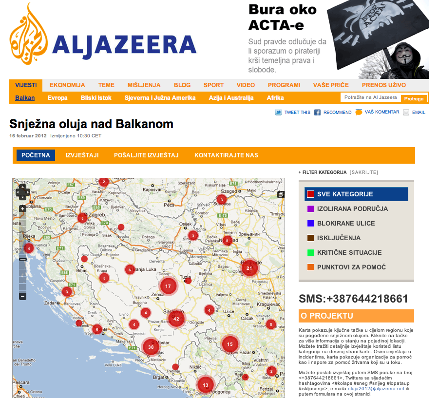
Al-Jazeera’s Crisis Map of the Snowstorm Emergency in the Balkans

In the Fall of Al-jazeera partnered with the SBTF to produce a crisis map in response to the earthquake in Van, Turkey. Earlier this month, our colleagues at Al-jazeera got in touch with the SBTF again, this time seeking support for their crisis map of the snowstorm emergency in the Balkans. They were in the middle of launching their map and were specifically looking for volunteers from the region who were fluent in the respective languages to monitor and map relevant tweets, emails and text messages.

So we sent out an email to SBTF volunteers and set up a dedicated Skype chat (as per standard operating procedure). We also used other networks to recruit volunteers from the region. About a dozen volunteers rallied to the cause and did an outstanding job, mapping over 250 relevant reports on issues ranging from blocked streets and isolated areas to critical needs and response services.

During the first two weeks after the launch, the crisis map was the most popular page on the Al-jazeera Balkans website, both on a daily and weekly basis. Even on the first day of the launch, the crisis map very quickly became the most read item of the week. According to our Al-jazeera colleagues, the crisis map was also the first to break the news on several incidents. In addition, the map provided the most comprehensive coverage of the snowstorm in the region. Indeed, the content populating the map was also shared via the Al-jazeera TV newsroom.

The mainstream media has always played an important role vis-a-vis the dissemination of information during and after a crisis. They typically have a lot more visibility and reach. As news organizations like Al-jazeera continue to innovate with new types of technologies and media, there is little doubt that crisis maps like the one above will increasingly form part of the mainstream news.


Posted in Uncategorized | Tagged , , , , | Comments closed

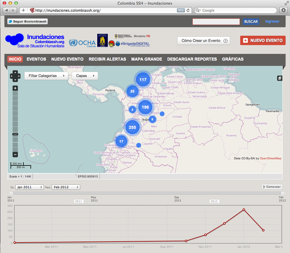
Updates from OCHA Colombia Floods Deployment

[Blog post by Virginia Brussa, SBTF Regional Coordinator for South & Central America]

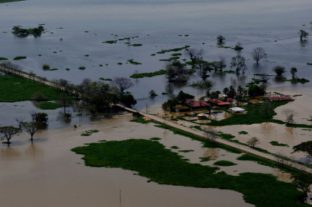
According to SIGPAD, the second rainy season affected 1,193,956 people of which more than 33,000 were affected in January alone. UN OCHA Colombia requested support from the SBTF in December to map the massive flooding triggered by the second season of rains in Colombia. The SBTF was thus officially activated and interested members of the network were immediately recruited to participate in this joint mapping project.

Some fluency in Spanish was necessary for this project, which posed both a challenge and important opportunity for the SBTF. Some 18 volunteers applied to support the project (including team coordinators) from December 19th onwards. Because of the holiday seasons, some volunteers were not able to remain engaged after applying and getting trained. Nevertheless, and even in spite of the language requirement mentioned above, volunteers came from diverse places:  Eliana Zemmer from Italy, Clara Straimer from UK, Catalina Mesesan - Sweden , Idriss Ait-Bouziès - Switzerland, Marta Poblet and Alberto Preato - Spain, Rosa Aguilar - Venezuela, Tom Weinandy and Robin Tolochko now in Bogotá , Colombia. We would like to sincerely thank these  SBTF volunteers and coordinators for their great help in supporting all the tasks required to carry out the following processes.

Together, volunteers monitored the media for relevant information as the Media Monitoring Team, approved and mapped reports as part of the Reports Team, geolocated places as part of the Geolocation Team and cross-referenced information as part of the Verification Team.

Specifically, the Flood Crisis Map in Colombia is a product of the Humanitarian Situation Room which comprises an Information Management Team with functions delegated from the Humanitarian Country Team. The Humanitarian Country Team brings together the agencies of the United Nations and the main international NGOs with projects in the country. The map is an effort on the part of different organizations to build and manage relevant flows of information. The objective is to identify emergency needs, responses given and finally assistance gaps.

Work on the crisis map involved visualizing important issues such as access to clean water, health, education, food security, shelter and income generation in different areas throughout Colombia. Floods, landslides and continuous mudslides-results of soil saturation and erosion-often left people isolated and hindered the help of humanitarian teams to the most affected areas. It is therefore important to emphasize the complementing role of information flow offered by this crisis map about these events and needs.

“Focus was given to areas with access problems related to the double impact on communities harmed by natural disasters with the presence of illegal armed groups.” Luisa Pineda, OCHA Colombia Information Coordinator, stressed.

Second winter season: Challenges in the mapping

Mapping was coordinated by Luisa Pineda of UN OCHA Colombia from December through January. She described the complexity of the situation during the rainy season and the new mapping process:

“Colombia has two rainy seasons per year, but during the second half of the rains were prolonged and that rainy season joined with the first half of rainy season. As a result, 27 of the 32 departments were affected by multiple disaster situations with a natural origin, at the time the first phase of deployment was activated in collaboration with various organizations and networks such as Brigada Digital , the Risk Management Office (now National Unit for Disaster Risk Management-UNGDR in Spanish) and the Ministry of Telecommunications.”

“In the new phase of deployment there are involved organizations such as the Humanitarian Studies Institute (HSI),  Centro de Estudios Estratègicos Latinoamericanos (CEELAT) , the networks of MinTIC and the SBTF. With protocols adapted for use by the Standby Volunteer Task Force and OCHA from other deployments as the Libya Crisis Map, we activated the Media Monitoring, Report, Geolocation and finally the Verification teams. All teams are coordinated through a Skype chat with an intranet where each team can work on guidelines and specific related documents.”

According to Jeffrey Villaveces, the head of the Information Management Unit in UNOCHA Colombia, the platform  ‘Inundaciones’ is being used to spearhead a much wider information management effort on the part of OCHA in the country,

“Our hope is to successfully implement ‘Inundaciones’ for this specific flood emergency, but we are in the process of rolling out an emergency event monitoring platform that is much wider in scope called ‘Monitor’.  Using a backend that will systematize events that we already have collected in SIDIH, sidih.colombiassh.org, ‘Monitor’ will allow these events to be visualized hand in hand with Humanitarian Access information, needs evaluations and responses in the field collected using OCHA’s other information processes. In this way, ‘Monitor’ becomes an important information management visualization tool for the humanitarian situation in the country in all of its aspects, integrating existing information management processes with new ones such as those implemented via Skype with volunteers to collect a variety of information. Our hope is to build on this tool to integrate the country’s disparate ‘Observatories’, giving them access to the information collected and systematized to add another layer of value-added with analytical reports.”

These efforts have helped to improve the information  quality and the research of  the second rainy season in Colombia. Final products are consulted by different humanitarian agencies and national and international  organizations.  These include humanitarian portals as Redhum with coverage in Latin America, and ReliefWeb, which is consulted worldwide.  Both portals are managed by OCHA, the latter example via a network of offices, and the former example from the Regional Office for Latin America and the Caribbean based in Panama.

Our veteran SBTF Report  Team  Coordinator Eliana Zemmer expands that idea: “I found the map a very useful service that can be accessed by a variety of government organizations and other organizations present on the territory. In a vast  country like Colombia it is useful to have a collection of data in a repository because it helps getting a clear picture on the situation and the development can be monitored that way. Useful also in terms of help/relief and of potential and possible actions to take on the ground.”

Some data provided to the Floods map through January

As a map of disasters events, this was an interesting exercise because all SBTF members should to take knowledge about the specifics categories  of the mapping (example: kind of land- movement), but also about specific issues of Colombia. Some of these were very important to understand what event could be created or approved. ”The approval of report at the beginning created a little bit of confusion for myself not being Colombian example  the terms used to indicate specific locations within the city “ said Eliana Zemmer.

Here is some data of the mapping deployment for the second rainy season:

487 reports were created and approved through January 30th,. There are 208 reports on land-movement related events (including events on landslides, mudslides, erosion due to the rainy season). This number represents the 36 % of the total reports generated. In second place, there were 137 reports created related to the flood category (23.7%). Other reports refer to events registered as alerts (12.1%) due to landslides, floods, wildfires and many others for humanitarian response in areas such as food, shelter, education in emergencies, health, water, sanitation and hygiene. It should be noted that, due to the nature of these types of events, land-movements have a higher mortality rate, and generate wider news coverage than flood events, which are gradual rather than sudden, and while very harmful in terms of impact on housing in many regions, generate fewer deaths and hence more limited numbers of reports.

Plurality of events were geolocated in Valle del Cauca department, in second place was the department of Caldas , followed by Cundinamarca (with many of these events near Bogotá-the capital city). Caldas department was widely covered due to a series of dramatic events, including a landslide which killed more than 40. Bogotá generated coverage due to this area being the capital, and the large number of news organizations concentrated there. It should be noted that, per official data, Chocó, Cesar and Magdalena departments were actually more intensely affected and had a larger total affected population than these other locations. However, a very limited news organization presence in these poorer and more sparsely populated areas meant fewer reports were fed into the system. This fact makes it clear that, aside from counting the number of events per se, tracking both official data and the number of affected persons is key to making a platform that fully informs decision-makers.

In this sense, the “shortage” of information about isolated rural areas is a challenge for humanitarian agencies of response, because they need to prioritize their actions under the criteria such as the quality, opportunity and equity and the humanitarian principles of impartiality, neutrality and operational independence.

Considering that scenario consequence of natural events and the media system, Idriss Ait-Bouziès  (SBTF volunteer and Geolocation Team Ccoordinator from UNV) added “Colombia is currently facing different kind of disasters,that leads to isolate various locations letting them without any possibility of moving. In that context, our help is more than necessary. Geo-localisation is crucial in such a situation, they need accurate data to be able to deploy aid where it is necessary.We have to learn quickly and be efficient to lighten our workflow so we can deliver exact maps in a short time.”

* Jeffrey Villaveces and Luis Hernando Aguilar (OCHA Colombia- Information Management Officers) have collaborated in this post. Thanks!


Posted in Uncategorized | Tagged , , , | 1 Comment

WHO Libya Deployment: Lessons Learned and SBTF Feedback

On December 12th, Robert Colombo Llimona, a GIS Analyst
for the Vulnerability and Risk Analysis & Mapping (VRAM) 
inside the WHO Mediterranean Center for Health Risk Reduction (WMC) based in Tunisia contacted the SBTF, OSM and GISCorps to request support on a project related to the public health system in Libya. The purpose of the project was to get a final Health Facility Registry GIS layer for Libya, which would include the location type and name of the Health Facilities (HF) across the country along with their status. This was to be the starting point for providing a crucial service to the local community since the public health infrastructure was starting to get back “online” as it’s capacity was starting to increase again, which would benefit the entire community and citizens.

WHO was looking for datasets to try to compile a basic layer to start working with. Once this basic layer (which included the HF’s that were in place before the revolution and fighting) was going to be compiled, WHO could properly start their assessment of the actual public health situation in the field and identify which HF’s were still operational, which ones weren’t, and in doing so collect the statistical data to create a strategy of fast recovery for the national health system

There were already some datasets to start from:

•  Google map maker
•  ICRC
•  WHO

Still there were some gaps in the layers and there was a need to identify and complete them.

WHO had two WHO staff already in Libya working on this specific project (collecting data, points, visiting places…) but they needed to be more precise in their approach, which is why they wanted to make sure we could gather all the existing, valid and original datasets.

The SBTF decided to start immediately a deployment and the following things where set up:

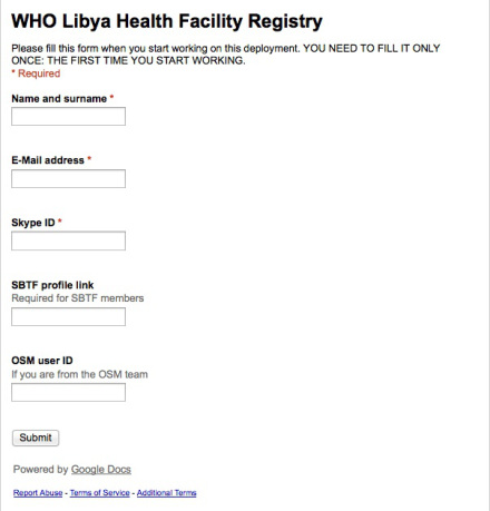
1) An application form for the volunteers to declare their availability

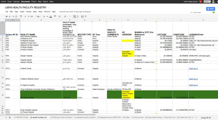
2) A Google spreadsheet with all the data already existing, possible sources and new sources founded by the volunteers

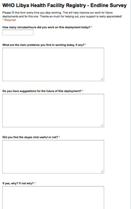
3) An endline survey for the volunteer to be checked on a daily bases and used to eventually change workflows and methodology according to the feedback gathered from the volunteers

The volunteers were coordinating all their efforts using a dedicated Skype Chat (standard operating procedure for SBTF deployments), and both the Skype Chat and the Application Form were shared with OSM in order not to duplicate efforts.

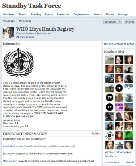
All the documentation necessary to inform volunteers on how to contribute to the effort was drafted and shared via the WHO Deployment Page created inside the SBTF Ning site:

The deployment run through the entire holiday period (December-January) and was paused for a couple of days to allow GIS Corps to clean and delete duplicate data  from the information found by the volunteers after the first 2 weeks of the deployment.

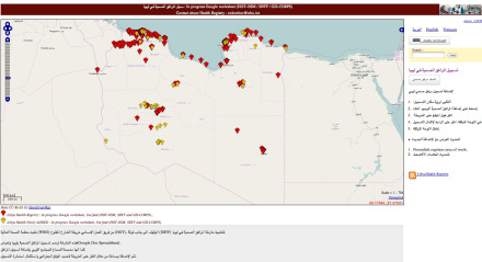
At the end of the deployment, when it was clear that no more information could be found on the web, the SBTF phased out of the deployment, giving way to the the second phase of the project: HOT/OSM created a web interface to allow anyone from Libya to add information missing on the health facilities founded by the volunteers, or to add new facilities not already inserted.

Of course this part of the project was particularly difficult because, as our collecgues in OSM state in their blog post on this project “We did have good contact with a number of interested Libyans, especially expat medical professionals. I think the call to participate must have gotten into the right channels. However, it was difficult to bring these folks in … being medical professionals, they’re really busy, mostly not in the same cities as us in the response, and not that familiar with mapping. They were super enthusiastic about the project, and for that I totally appreciate, and hope we can find a way to collaborate more as things develop.”

WHO has already described this project in detail in their guest  blog post here, so I will use this post to describe a bit more the SBTF’s involvement in this project and will share the comments, feedback, opinions of volunteers who participated in this novel public health deployment.

Overall the SBTF had 76 volunteers participating in the deployment, 12 of them from the OSM team, and most of those part of both SBTF and OSM networks.

The average amount of time spent daily by each SBTF volunteer on the deployment was 75 minutes, with some volunteers working 3 hours in a row and some no more than 10 minutes. In general the majority of the volunteers did around 1 hour a day.

The major problem that volunteers highlighted was related to the different spellings of the local locations and the difficulties in finding addresses on any available maps on line. This was frustrating and time consuming for volunteers – and gave our colleagues at GISCorps a lot of work vis-a-vis the data cleaning operation after the first two weeks of the deployment.

Thanks to the feedback and suggestions provided by SBTF volunteers, we were able to adapt and make changes to the deployment several times throughout the project life cycle. For example, we added a column for the phone numbers of individual facilities, another one for the web address, and another one with the status of that entry. We also added a dedicated page to compile all the useful sources found by the volunteers. This enabled others to do some cross-validation and verification.

Almost 90% of volunteers found the Skype Chat useful and a good way to ask questions, share information and learn about what others were doing and how. Some volunteers emphasized that they found the Skype Chat particularly important for the “spirit”. Being able to chat with each other while working was a definite plus and a form of ongoing encouragement.  The majority of the volunteers used the chat to get quick feedback on their questions and to get up to speed of what was most needed. Unfortunately, since the majority of the volunteers were based in the US, whom was in a different time zone, was left almost alone in the Skype Chat.

Lessons Learned:

  • The SBTF should have more coordinators in different time zones to make sure that all volunteers have a reference point;
  • The use of local volunteers needs to be increased at the earlier stages of the deployment if and where possible;
  • When working with local languages spelling issues and transliteration problems really do handicap the efforts of the volunteers to find accurate information. Guides or standard protocols needs to be created to minimize those risks;
  • Endline survey needs to become a standard protocol to make sure that all volunteers can anonymously report issues and problems on a daily bases and that the managers of the deployment gather feedbacks in a timely manner;
  • Having the activators in the skype chat with the volunteers was incredibly useful. Robert Colombo was supporting and coordinating the volunteers on a daily bases and this gave them also a very good understanding of the use of the data collected.
Posted in Uncategorized | Tagged , , , , , , , , | Leave a comment

Data Protection Standards 2.0

As noted in Patrick Meier’s blog post on “Crowdsourcing, Crisis Mapping and Data Protection Standards”, humanitarian organizations have yet to develop and publicize data protection protocols for social media, crowdsourcing and volunteer geographical information. This is why, in November the standbytaskforce.com actively participated in an important workshop to discuss these challenges.

The workshop was organized and sponsored by World Vision (WV) and deliberately scheduled around the Crisis Mappers Conference in Geneva, Switzerland. This was quite possibly one of the most important meeting that we (as the SBTF) participated in all of. For the first time, we had a dedicated space to share our challenges and questions with data protection experts. Participants included representatives from the International Committee of the Red Cross (ICRC), Care International, Oxfam GB, UN OCHA, UN Foundation, Harvard Humanitarian Initiative (HHI) and obviously WV.

We discussed in depth issues surrounding Do No Harm, Informed Consent, Verification, Risk Mitigation, Ownership, Ethics and Communication, Impartiality, etc. A clear outcome of the workshop was there a clear need exists for developing and sharing guiding principles to inform the work of both volunteer networks (like the SBTF) and humanitarian organizations. Our colleagues at the ICRC have since taken the lead on developing protocols relevant to a data 2.0 world in which volunteer networks and disaster-affected communities are increasingly critical. We expect to review the latest draft in the coming weeks after Oxfam GB has added their comments to the document. The report of the workshop is available here and highly recommended.

Obviously, these data protection challenges are not new. Many of us in the SBTF have been confronted with them since we launched in. We have actively been reaching out for guidance on such issues, included security-related challenges, as per this blog post from early. Humanitarian organizations are also aware of these complex challenges. The International Organization for Migration’s report on Data Protection Standards, a 150+ page report, is devoid of any reference to social media even though disaster-affected communities are increasingly generating digital information relevant for humanitarian response operations.

To this end, this new piece from the Sudan Satellite Sentinel Project (SSP) is quite suprising, not because it says anything new but because it draws on discussions that have been going on for quite some time now in the Crisis Mappers community.

Set of Ethical & Techl Standards for How to Use New Tools Safely & Strategically

This issue has been discussed broadly at ICCM where more than one self organized session was specifically about this issue. UN personnel, NGOs, practitioners and software companies participated in the sessions discussing in between other topics the deployment of crisis mapping projects under repressive regimes, the use of social media in repressive regimes and the security protocols for verification and privacy.

The SBTF in particular has developed in the last year several documents in order to manage those issue: in the Libya deployment the verification protocols designed by the SBTF were accepted and revised by UNOCHA before being implemented for example. A threat and mitigation strategy was also provided to and accepted by OCHA. In addition to this, and before the Libya crisis, the SBTF has been designing security protocols and blogged about possible measures to be taken when crisis mapping repressive regimes.

The struggle to find common standards and draw on lessons learned is common in the field and this is the reason why the same Crisis Mappers Network created, under the lead of co-founder Jen Ziemke, a Security Working Group inside the network. A lot still needs to be done and proactive actions are being taken by those interested in actively working together to constructively address the issue.

Standardized Training, Tech Benchmarks, and Peer-Reviewed Codes of Ethics

The SBTF has now standardized training for all our teams, training that has been also shared with UN practitioners for their feedback and material which has also been informed by two professional crisis simulations - one with UN SPIDER and one with UN OCHA. A third, upcoming simulation is scheduled this Spring in partnership with HHI. Our training and workflows have proven successful in our deployments, at the point that they are now being used by UNOCHA in Colombia for their emergency response crisis mapping project. Incidentally, all of these workflows are openly available on the SBTF website.

Our Code of Conduct for volunteers has been shared with both the International Red Cross and the UN for their feedback, and is entirely designed based on the Red Cross Code of Conduct. Co-founder Patrick Meier has been discussing both inside the standbytaskforce.com Core team, with our partners and inside the Crisis Mappers google group about the design of a common SMS code of conduct, while another co-founder, Anahi Ayala Iacucci, is actively working with Internews on the development of a Community of Interest about Communication with Disaster Affected Communities - communication system which we have training material on and which is available to SBTF volunteers on our Ning platform.

Learning and Evaluation

This part of our work has been something we have been trying to address consistently in the course of the past year. The SBTF has publicly released three reports on our most important deployments, which include lessons learned, problems, issue and possible mistakes done during deployment to make sure that all those factors are taken into account for future deployments. All our major deployments have public blog posts that describe in detail the deployment and try to evaluate the outcomes and the results of those deployment. See here for a complete list of that documentation.

Guidelines for guaranteeing the safety of informants, and frameworks to hold practitioners responsible for adherence to ethical and technical standards

The protection of data exchanged and used during our deployment has been and will always be an issue that we realized needs to be carefully dealt with on a case by case level. The World Vision workshop held in Geneva on data protections was a great occasion for us to share our concerns and problems with practitioners and experts in the field, like ICRC, HHI and UN agencies. As SBTF we have been learning a lot especially during the Libya deployment where for example the UN decided to publish the map we were working on but only after cleaning the data from sensitive information contained into it.  The need for common guidelines and share protocols is definitely there and all practitioners working on the ground feel this needs as t be one of the most important to be addressed. For this reason Security was one of the 3 main topics highlighted in the Crisis Mappers conference in Geneva.

Activation Protocols

We are quite flattered by the remarks in article by Sudan Sentil Project referring to “crisis mappers” as being the new first responders. Unfortunately, we can’t take credit for that. The affected populations are by definition the first responders. Then come the professional humanitarian organizations, whether local, national or international. At the SBTF, we have clear “Activation Protocols” that dictate where and when we engage in official SBTF deployments. These have also been reviewed by several humanitarian organizations including UN OCHA. We don’t mobilize on a crisis mapping project just because we feel like it. We are volunteers with other professional/academic demands on our time. A specific list of criteria first need to be met. So while the Sudan Project article might be referring to the SBTF at times when they talk about “crisis mappers”, it is worthwhile to know that we typically work in partnership with established humanitarian organizations.

We don’t have all the answers, and never will. We are a volunteer network actively looking for support and guidance. We are grateful to the ICRC for taking the lead on drafting possible protocols to guide our work and we openly invite any other experts out there to help us in mainstreaming data protection 2.0 protocols into our workflows and operations. But there’s a lot more that we need guidance on. So if you are a lawyer, and interested in providing pro-bono support, to audit our work flows and provide us with concrete, actionable guidance on digital data protection issues for 21st century humanitarian response, please get in touch-we need about 10 of you!

In the meantime, we’ve collectively started this Working Group on Data Protection as part of the Crisis Mappers Network. While the Security Working Group initially included Privacy, these are major issues that each need individual, focused attention. As a first step, the goal of the Data Protection Working Group will be to identify and list the data protection questions that need to be addressed within the context of social media, crowdsourcing and volunteer geographical information systems. We will then share these with the data protection experts, we are already working on this topic with. But we will also use this Working Group to brainstorm some suggestions vis-a-vis possible protocols.

Contributors to this blog post: Anahi, Patrick & Jeannine

Posted in Uncategorized | Tagged , , , , , | 6 Comments

Testing UNOSAT’s Cybermappr tool

[This is a guest blog post by Lars Bromley, Analyst at UNOSAT]

Dear SBTF,

I wanted to convey my deep appreciation for the time that you recently spent testing and offering suggestions for the Cybermappr tool under development by the United Nations Institute for Training and Research / Operational Satellite Applications Program (UNITAR/UNOSAT) and the Citizens Cyberscience Centre (CCC). Cybermappr is an experimental effort that begins to address a need by UNOSAT for converting the many photos and other media that appear during crisis periods into categorized and georeferenced data via crowdsourcing.

While its true that all media will probably one day be categorized and georereferenced at the source, UNITAR/UNOSAT felt that this future was too slow in coming. Effectively utilizing pictures and other media captured by mobile phones and similarly ubiquitous technologies in crisis response was a slow and tedious process for staff to undertake,  so Cybermappr is intended to farm that task out to the crowd. The Cybermappr trial with SBTF attempted to address two primary questions in this regard: can crowds reliably find and categorize media across the internet based on a few simple guidelines, and; can crowds then map that media to a specific location based on clues found in the media and any related text? For this experiment Cybermappr was oriented to locating and mapping photos of buildings in Libya damaged during the recent conflict.

While the SBTF volunteers assigned to this effort were not quite a crowd they did provide critical input, feedback, and guidance to the Cybermappr effort. More than 200 new photos were added and filtered, a third were ‘rejected’ as invalid, a quarter were linked to other photos as showing the same location, and only a few were actually placed on the map. More broadly, SBTF verified that media can indeed be located and categorized in rapid fashion, which is no surprise of course, but also that the georeferencing aspect is extremely hard for everyone so the Cybermappr georeferencing interface needs a lot of improvements to be effective. The georeferencing aspect is the main point of Cybermappr so we’re grateful for the input on what’s needed to make it better. Several of the specific comments we received from SBTF are currently being implemented by our developers and some of the deeper issues will be discussed at the upcoming Citizen Cyberscience Summit

So, thank you all for your help we look forward to re-engaging with you once Cybermappr gets to its next phase!

Best,

Lars Bromley


Posted in Uncategorized | Leave a comment

Meet a Mapster: Understanding Volunteer Motivations

[This is a guest blog post by Isaac Griberg, Social Media Officer at the International Committee of the Red Cross (ICRC) and MA Social Media student at Birmingham City University]

Dear Mapsters,

First of all, kudos for all the work you guys are doing at the intersection of GIS and relief work. I believe the humanitarian community needs an injection of not only your skill set, but also your passion and dedication. In my work I often touch on topics related to the SBTF and other V&TCs. Many times I have been stunned by your neat applications and slick sites offering ways for the public to provide first responders with crisis data, but never have I understood who really ‘pulls the rope’ on the back-end. Who are you?

To answer this question I finally decided to conduct a small study within the framework of my graduate class. While most researchers in the field of crisis mapping have looked at the technology, I decided to shed some light on the volunteers themselves - you - who did the heavy lifting of initiatives like LibyaCrisisMap. Ultimately I wanted to learn about your motivation in doing volunteer work. The findings, presented below, might not represent the entire SBTF community and should be treated as a base for further studies.

According to the study:

  • A typical SBTF volunteer is male and 32 years old. He holds, or is currently enrolled in studies leading to, a Master’s degree in computer science, development studies or international relations. He often works as expert in GIS or ICT and has some experience from public sector or non-profit environments.
  • SBTF volunteers are genuinely concerned about the people they help. To them volunteer work provides an opportunity to learn through ‘hands-on’ experience, to further one’s professional career, and to make new friends. Some seek new perspectives or self-esteem, while few seek recognition or a means to overcome guilt of being more fortunate than others.

Is this you? Please do leave a comment (or tweet me). Keep up the good work and, finally, a big THANKS to Patrick Meier and the 60 mapsters who kindly participated in the study. You guys rock.

Over & Out,
Isaac


Posted in Uncategorized | Tagged , , , | 2 Comments

Regional Teams and Regional Data

Regional Teams are definitely not a new concept at the SBTF and every member is assigned to a Regional Team, depending on his/her location. Given the SBTF’s phenomenal growth and frequency of deployments, the need for increasingly effective and uncomplicated coordination/ cooperation is obvious. The regional teams are one of the instruments of the SBTF to embrace this need. So, what is the vision behind the Regional Teams? What do we hope to achieve through this categorization? How are deployments likely to benefit from these Regional Teams? This post is an attempt to respond to these questions and more.

Efficiency and timeliness are key as we deal with live maps in a crisis. Let’s say there’s a need to map a flood-hit remote region, which doesn’t have much of an online presence yet. Meaning, village X in this flood-hit region, which is in dire need of food supplies, cannot be easily mapped. In such cases, if we had a database of local NGO contacts in/ around the flood-hit region handy, we could simply connect with a few such organizations right away and seek help with the location. Chances are that at least one out of ten organizations would respond. The approach just described is definitely not new. Seeking help from other organizations/ personnel indeed happens during deployments, like in the case of Haiti. The idea is simply to be proactive in identifying such potential needs and collecting the required information in advance, so that during a crisis, where every second counts, we don’t have to make a hurried scramble to identify people and organizations who could possibly help.

In July less than 3 hours after the attacks in Mumbai, India, a crisis map was deployed and the SBTF volunteers got on board to map needs and impact of these attacks. Details on this crisis were more comprehensively covered by the regional media as opposed to the international ones. A key task, therefore, was identifying the list of relevant/ important regional media sources to gather information from. While this is no huge bottleneck in itself, it would have helped to have a pre-identified list of credible Indian media sources (both English and vernacular), so that the Media Monitoring team had something to start with right away instead of spending time researching credible local sources.

Scenarios of the kind described above are not specific to any one crisis but are often encountered in several deployments, in varying forms and measure. Every deployment comes with its own set of regionally specific data, gaps and sensitivities that have to be factored in. Where possible, identifying such data for as many regions as possible and in advance of any crisis, is definitely advantageous. Of course, not every need can be identified in advance and there are some which are very unique to each crisis but the common ones can and definitely should be addressed. This could be described as the SBTF’s emergency preparedness plan and this is where the Regional Teams step in.

What if volunteers in any deployment had access to a miniature “SBTF Country encyclopedia”, which would serve both as an emergency directory and a 2-minute deployment-related “crash course” on the specific country, to help smooth at least a few deployment tasks? Sounds ambitious, yes, but definitely worth an attempt and this will be a key focus of the SBTF Regional Teams. While an emergency directory could contain contact listing for local NGOs, local media sources, etc the latter could contain pointers specific to each country that could come in useful to volunteers during deployments. An important consideration here would be to ensure that the organizations and sources that we gather are indeed credible.

So what do we mean by the aforementioned “pointers”? A pointer could be just about any information that will likely help volunteers, who are not familiar with a particular country, during a deployment. This is where regional considerations, if any, that need to be factored into a deployment are collected. Who provides these pointers? The larger SBTF community which has volunteers from nearly 70 countries! Volunteers can offer information/ their opinion/ suggestions on just about any country they are familiar with and on absolutely any subject they feel will come in handy during a deployment. The information offered by these pointers could be incorporated into the overall deployment strategy as helpful country-specific considerations So, a sample pointer from a volunteer familiar with country X could be: “Beware of vernacular media reports when mapping in country X. Heavily biased”. This would translate to increased caution from volunteers when dealing with vernacular media reports during deployments in country X. Or “Rural regions always under-reported” which could possibly suggest an SBTF strategy to include more trusted, rural organizations to directly source information from. Or “low Internet penetration.” translating to lesser first person accounts (Tweets, Facebook, etc). Just about anything goes as a pointer!

Logically speaking, the Regional Teams are the obvious owners of this task of building such a repository. This is because only those who are living in/ familiar with a particular region can truly understand and appreciate the realities that can affect a region as well as the customs, language, knowledge and work of organizations on the ground.

So, how/ where would this encyclopedia help? Apart from slightly reducing the work of volunteers during deployments, this dataset could also help in the following ways:

Comprehensive Information Gathering and Information Verification: Not all events/ incidents are available on mainstream media, social media or official sources. Sometimes, the smaller, local organizations have greater access to information than media sources or international NGOs. Having a database of such trusted, local NGOs handy ensures that we have the resources to tap into for more comprehensive information, if ever there is a need. Similarly, in the event that media sources do not sufficiently corroborate a particular information for verification purposes, knowing what trusted and local organizations to directly contact, to confirm a specific report, would be very helpful.

Deployment Direction: The SBTF is activated by and works under directions of a deploying organization, usually on the ground and involved directly in response. However, given the novelty and volatility accompanying any major crisis, it helps to be proactive as we help the deploying organization improve its situational awareness. One option, with the vetted local NGO contacts that we identify, would be to identify a small SBTF team to initiate and maintain conversation with a few of these organizations, through the duration of the deployment. As discussed, local organizations often do have better insight into realities on the ground, projections for the future, etc. They are also often good sources to comment on early signs of an emerging crisis or indications of one crisis spawning another (like a natural disaster leading to a health crisis) - trends which start very local in scope before spreading to a wider expanse. If there are any important suggestions/ directions/ emerging patterns that these conversations with the local NGOs lead to and that are worth pursuing to better help the affected population, we could proactively relay those to the deploying organization.

Voice for those unheard: During times of crisis, the needs of the smaller organizations are not always heard. Having such a database gives us access to trusted, smaller organizations serving a very localized population and often independent of the country’s humanitarian cluster team. A worthwhile exercise could be mapping the non-monetary needs of such smaller organizations. Of course, a key precedent would be to ensure that these organizations are trustworthy and that the information they provide is true.

For the above and more, the emergency preparedness information or encyclopedia described above would be very beneficial and this is something the Regional Teams are looking to build for each region. If you are convinced that data of this nature would be helpful, you are most welcome to join us in our efforts to build this regional data.

- Virginia, Svend and Bharathi

Posted in Uncategorized | Tagged | Leave a comment