How the UN Used Social Media in Response to Typhoon Pablo (Updated)

Cross-posted from iRevolution.

Our mission as digital humanitarians was to deliver a detailed dataset of pictures and videos (posted on Twitter) which depict damage and flooding following the Typhoon. An overview of this digital response is available here. The task of our United Nations colleagues at the Office of the Coordination of Humanitarian Affairs (OCHA), was to rapidly consolidate and analyze our data to compile a customized Situation Report for OCHA’s team in the Philippines. The maps, charts and figures below are taken from this official report (click to enlarge).

Typhon PABLO_Social_Media_Mapping-OCHA_A4_Portrait_6Dec2012

This map is the first ever official UN crisis map entirely based on data collected from social media. Note the “Map data sources” at the bottom left of the map: “The Digital Humanitarian Network’s Solution Team: Standby Volunteer Task Force (SBTF) and Humanity Road (HR).” In addition to several UN agencies, the government of the Philippines has also made use of this information.

Screen Shot 12-08 at 7.26.19 AM

Screen Shot 12-08 at 7.29.24 AM

The cleaned data was subsequently added to this Google Map and also made public on the official Google Crisis Map of the Philippines.

Screen Shot 12-08 at 7.32.17 AM

One of my main priorities now is to make sure we do a far better job at leveraging advanced computing and microtasking platforms so that we are better prepared the next time we’re asked to repeat this kind of deployment. On the advanced computing side, it should be perfectly feasible to develop an automated way to crawl twitter and identify links to images  and videos. My colleagues at QCRI are already looking into this. As for microtasking, I am collaborating with PyBossa and Crowdflower to ensure that we have highly customizable platforms on stand-by so we can immediately upload the results of QCRI’s algorithms. In sum, we have got to move beyond simple crowdsourcing and adopt more agile micro-tasking and social computing platforms as both are far more scalable.

In the meantime, a big big thanks once again to all our digital volunteers who made this entire effort possible and highly insightful.

Posted in Uncategorized | Leave a comment

Summary: Digital Disaster Response to Philippine Typhoon

Cross-posted from iRevolution

The United Nations Office for the Coordination of Humanitarian Affairs (OCHA) activated the Digital Humanitarian Network (DHN) on December 5th at 3pm Geneva time (9am New York). The activation request? To collect all relevant tweets about Typhoon Pablo posted on December 4th and 5th; identify pictures and videos of damage/flooding shared in those tweets; geo-locate, time-stamp and categorize this content. The UN requested that this database be shared with them by 5am Geneva time the following day. As per DHN protocol, the activation request was reviewed within an hour. The UN was informed that the request had been granted and that the DHN was formally activated at 4pm Geneva.

pablo_impact

The DHN is composed of several members who form Solution Teams when the network is activated. The purpose of Digital Humanitarians is to support humanitarian organizations in their disaster response efforts around the world. Given the nature of the UN’s request, both the Standby Volunteer Task Force (SBTF) and Humanity Road (HR) joined the Solution Team. HR focused on analyzing all tweets posted December 4th while the SBTF worked on tweets posted December 5th. Over 20,000 tweets were analyzed. As HR will have a blog post describing their efforts shortly (please check here), I will focus on the SBTF.

Geofeedia Pablo

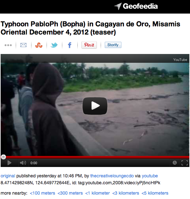
The Task Force first used Geofeedia to identify all relevant pictures/videos that were already geo-tagged by users. About a dozen were identified in this manner. Meanwhile, the SBTF partnered with the Qatar Foundation Computing Research Institute’s (QCRI) Crisis Computing Team to collect all tweets posted on December 5th with the hashtags endorsed by the Philippine Government. QCRI ran algorithms on the dataset to remove (1) all retweets and (2) all tweets without links (URLs). Given the very short turn-around time requested by the UN, the SBTF & QCRI Teams elected to take a two-pronged approach in the hopes that one, at least, would be successful.

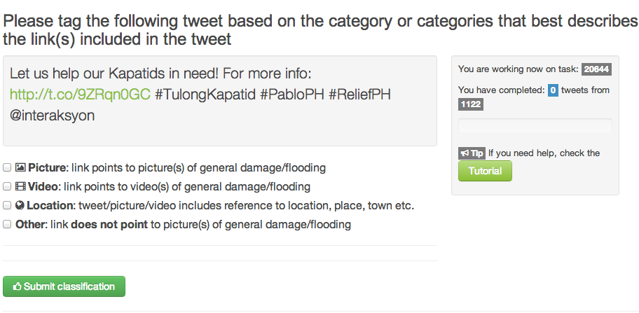
The first approach used  Crowdflower (CF), introduced here. Workers on Crowd-flower were asked to check each Tweet’s URL and determine whether it linked to a picture or video. The purpose was to filter out URLs that linked to news articles. CF workers were also asked to assess whether the tweets (or pictures/videos) provided sufficient geographic information for them to be mapped. This methodology worked for about 2/3 of all the tweets in the database. A review of lessons learned and how to use Crowdflower for disaster response will be posted in the future.

Pybossa Philippines

The second approach was made possible thanks to a partnership with PyBossa, a free, open-source crowdsourcing and micro-tasking platform. This effort is described here in more detail. While we are still reviewing the results of this approach, we expect that  this tool will become the standard for future activations of the Digital Humanitarian Network. I will thus continue working closely with the PyBossa team to set up a standby PyBossa platform ready-for-use at a moment’s notice so that Digital Humanitarians can be fully prepared for the next activation.

Now for the results of the activation. Within 10 hours, over 20,000 tweets were analyzed using a mix of methodologies. By 4.30am Geneva time, the combined efforts of HR and the SBTF resulted in a database of 138 highly annotated tweets. The following meta-data was collected for each tweet:

  • Media Type (Photo or Video)
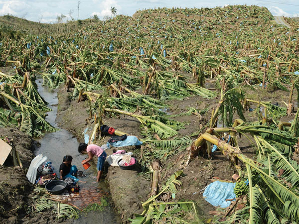
  • Type of Damage (e.g., large-scale housing damage)
  • Analysis of Damage (e.g., 5 houses flooded, 1 damaged roof)
  • GPS coordinates (latitude/longitude)
  • Province
  • Region
  • Date
  • Link to Photo or Video

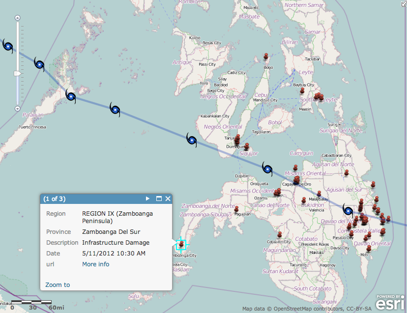
The vast majority of curated tweets had latitude and longitude coordinates. One SBTF volunteer (“Mapster”) created this map below to plot the data collected. Another Mapster created a similar map, which is available here.

Pablo Crisis Map Twitter Multimedia

The completed database was shared with UN OCHA at 4.55am Geneva time. Our humanitarian colleagues are now in the process of analyzing the data collected and writing up a final report, which they will share with OCHA Philippines today by 5pm Geneva time.

Needless to say, we all learned a lot thanks to the deployment of the Digital Humanitarian Network in the Philippines. This was the first time we were activated to carry out a task of this type. We are now actively reviewing our combined efforts with the concerted aim of streamlining our workflows and methodologies to make this type effort far easier and quicker to complete in the future. If you have suggestions and/or technologies that could facilitate this kind of digital humanitarian work, then please do get in touch either by posting your ideas in the comments section below or by sending me an email.

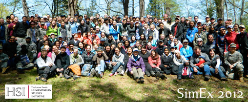
Lastly, but definitely most importantly, a big HUGE thanks to everyone who volunteered their time to support the UN’s disaster response efforts in the Philippines at such short notice! We want to publicly recognize everyone who came to the rescue, so here’s a list of volunteers who contributed their time (more to be added!). Without you, there would be no database to share with the UN, no learning, no innovating and no demonstration that digital volunteers can and do make a difference. Thank you for caring. Thank you for daring.

Posted in Uncategorized | Tagged , , , , | 1 Comment

Video: The standbytaskforce.com in Action

I was recently invited to give a 5-minute talk on the SBTF in action. This was for the Frontiers in Development conference organized by USAID just a few weeks ago. They have just made the video public. In this presentation, I describe the SBTF’s recent projects in Libya and Somalia, and with USAID’s Credit Authority Program. Huge, huge thanks to all Mapsters (SBTF volunteers) who made these three groundbreaking projects possible!

Posted in Video | Tagged , , | Leave a comment

OCHA South Sudan Deployment: Curating Data for Disaster Preparedness

On Monday, July 2nd, the Digital Humanitarian Network (DHNetwork) received a request for activation from UN OCHA’s Coordinated Assessment Support Section. OCHA is responsible for leading the development of some of the first information products when a crisis hits. These products define the initial situation at a multi-sectoral level helping guide the delivery of goods and services during the first weeks of an emergency. The deployment aimed to collect secondary data to include in the materials used in conducting these initial analyses for South Sudan. The data would be provided as a starting point for further data collection to an OCHA assessment team visiting South Sudan.

On Tuesday, July 3rd, the DHNetwork proposed that the SBTF be the Solution Team for this activation request. The SBTF was subsequently activated in partnership with OCHA. This was an interesting deployment for the SBTF, since it was essentially an exercise in crowdsourcing the curation of information - finding data online and providing it in a standard format to render it easily usable by OCHA. Volunteers were asked to search for data on population, displacement, returnees, refugees, security incidents, schools, water sources, health facilities and economic constraints - all aggregated at the county and state levels. The screenshot below (of OCHA’s online data repository) shows how little was available to the OCHA team prior to their field visit:

As requested by OCHA, the SBTF activated volunteers within 48 hours. A team of volunteers then worked for 3 days, trawling the internet for reports, articles and anything they could get their hands on, and collected a total of 1767 unique rows of data and 15,271 unique pieces of information records (see map below, generated by David Litke):

The morning after the volunteers finished, the OCHA team emailed us the following:

“It’s morning in Geneva (and Juba), and we just wanted to touch base with all of you out there working around the clock to collect all of this information for our team in South Sudan.  We continue to be blown away by how much information you are gathering-and the detail of it!-and want to again extend our thanks and sincere appreciation for your hard work.”

Another OCHA colleague also wrote to indicate that this deployment was not only about delivering a product, but also about the future of Volunteer and Technical Communities (V&TCs) collaborations:

“The lessons learned from this deployment will go beyond the case of South Sudan and will benefit the entire humanitarian community, as it will help OCHA identify how partnering with SBTF can contribute to informing a more effective humanitarian response in the future.”

So with this in mind, what have we learned? Two key lessons stand out for us. First, it is clear to us that crowdsourcing curation of information can be very helpful to humanitarian preparedness and response. Specifically, the value added of crowdsourcing in this deployment was to have many creative minds looking for alternative sources of information that the OCHA team might not have thought of. A few hours before the end of the agreed deployment, volunteers received the UN Information Management Working Group Digital Atlas for South Sudan. This extensive UN dataset contained much of the information OCHA required for their field mission in South Sudan. The identifcation of this dataset late into the deployment made the volunteer team wonder why it had not been made available at the start of the deployment. Therefore, our first lesson learned is that it is crucial for any activator of an ‘information curation’ type deployment to perform an initial search of existing sources of information that exist within their organization in order to identify any gaps and outdated information for which they would need SBTF’s crowdsourcing capabilities. This would ensure that volunteers are building on previous efforts rather than duplicating them and provides more value to our volunteers’ work and the overall objective of the deployment.

Second, the lead time for non-emergency deployments should be at least two weeks. The SBTF and other V&TCs are very keen to support preparedness activities by humanitarian actors. However, volunteers can’t be expected to mobilize quickly and drop other commitments for a non-emergency deployment. It is unnecessary, and may burn out volunteer goodwill for actual emergency situations. It is also worth noting that this activation occurred during July 4th (major public holiday in the US).

The volunteers involved enjoyed working with the OCHA team, and appreciated their efforts in keeping in touch. The team is also curious to see what the outcomes of this information curation process are. We look forward to an evaluation from OCHA that address how useful this was to their team in the field and what tangible results it contributed to.

The deployment is now over, but SBTF volunteers are still looking at ways to support OCHA’s South Sudan team. A group of SBTF volunteers is going to put together a training exercise and challenge to analyse the data collected and come up with some good summaries, graphics  and maps to visualize the story of South Sudan. We look forward to sharing the results of this exercise.

And our work may not be done yet! Souktel, a mobile services organization connecting aid agencies with communities who need help, contacted SBTF co-founder Patrick Meier to offer their support with follow up SMS-based data collection for South Sudan. Souktel’s mobile-based data collection solution combined with SBTF’s crowdsourcing capabilities could help fill some of the information gaps that are identified after OCHA’s field mission. Stay tuned for more news on a possible SBTF-Souktel-OCHA partnership…

Posted in Uncategorized | 1 Comment

SBTF presentation at Understanding Risk: conflict sensitive crowdsourcing

[Cross-posted from Helena's blog.]

This week I spoke at the Understanding Risk conference in Cape Town on a panel that explored successes and difficulties in the application of crowdsourcing for development and disaster risk reduction, together with colleagues from Humanitarian Open Street Map, the Public Laboratory, Ushahidi, Idibon and the World Bank. I focused on the particular challenges of conflict sensitive crowdsourcing. Disaster risk management practitioners are often concerned with the additional challenges of disaster response in conflict and post-conflict settings. I shared four case studies in Somalia, Syria, Libya and Sudan. Only one of these (Somalia) relates to a natural disaster, but together they illustrate some of the core questions around conflict sensitivity and crowdsourcing.

Somalia: UNHCR asked the standbytaskforce.com (SBTF) to crowdsource the location of shelters in the Afgooye corridor in Somalia, where a large number of people were displaced during the drought in. Tagging shelters helped with population estimates to support UNHCR’s logistics planning. Volunteers had access to satellite imagery of the corridor courtesy of Digital Globe. An application developed by Tomnod presented them with squares of imagery where they tagged anything that looked like a shelter (following a set of guidelines). Tomnod’s crowdrank algorithm then determined what tags were trustworthy. 

Syria: The SBTF was asked by a big humanitarian response organization to carry out a similar exercise in Syria – using the crowd to map health facility locations. However, the source of information would be local informants, who would also report on functionality. After careful consideration of potential security implications for informants and political repercussions for the organization, the deployment was cancelled.

Libya: The Somalia and Syria projects were both simple “ask the crowd to find a location” exercises. Crowdsourcing can also be a tool for collecting more complex, contextual information in a conflict setting to aid response. In UN OCHA asked the SBTF to put together a map of Libya that would collect information to help put together a picture of what was happening on the ground at the very start of the picture. UN OCHA believed that curating information from traditional media, social media and selected NGO workers and journalists on the ground would support humanitarian preparedness. Volunteers also collected information on responses, putting together a first draft of the “3Ws” (who, what, where) – a traditional UN OCHA information product for humanitarian response. A number of organizations, including OCHA, WFP, UNHCR and the Red Cross, reported that they found the useful. UN OCHA explained that the map “reduced information overload, produced an output that was manageable and digestable and led to better planning and decision making”.

Sudan: Crowdsourcing to report on a complex situation has been less successful in Sudan. UNDP has for the past few years collected information on conflicts, threats and risks, using local focus groups to generate localized, geo-referenced accounts of community perceptions. The perceptions are used for planning by both Government institutions and the UN. But organizing focus groups takes time and requires access to remote locations, so the information is inevitable always somewhat dated. UNDP designed a pilot to extend this information collection system to include information crowdsourced through SMS reporting, updating on the same topics focus groups discuss. At a time when information is highly sensitive, the pilot has faced a number of hurdles and is yet to be operationalized.

These four examples suggest that complexity is not the main hurdle to crowdsourcing in conflict settings; ethical questions are. Applying the “Do No Harm” principles – a benchmark of conflict sensitive programming – helps unpack some of the ethical questions these projects raise. Do No Harm stipulates that the highest priority should be placed on the safety of the general public. In the case of crowdsourcing, any activity that could potentially endanger affected populations that are the source or target of information during a disaster response operation must be carefully considered. Where information is sensitive, anyone involved in providing or collecting data can become a target for repercussion. The safety considerations are different for people local to the conflict (Syria) versus crowd members operating remotely (Somalia). There is a difference if the crowd is the workforce processing information (Somalia) as opposed to the source of the information (Syria). This concern about safety accounts for the different outcomes of the Somalia and Syria deployments.

Even where safety is not a pressing concern, Do No Harm requires that we ask questions around neutrality. Specifically, any crowdsourcing activity should assess whether it is building on what connects groups and avoiding anything that increases divisions. The Libya map, with its focus on contextual data already publicly available, passes this neutrality test. Work on a crowdsourced early warning system in Sudan is more complicated – debates between different actors on data ownership and verification of reports highlight the potential effects of data on connections and divisions in a fragile setting.

These are only some initial thoughts. Crowdsourced solutions to data collection and processing are growing in many fields, including disaster risk management. As these solutions are adopted into the mainstream, deployments in conflict and post-conflict settings are also likely to grow. Our thoughts on conflict sensitive crowdsourcing will need to develop alongside.

Posted in Uncategorized | 1 Comment

Lessons learned from USAID’s first crowdsourced project

[Guest post by Timo Luege - I’m passionate about information, communication and how they can be used to make the world a better place.
My two main areas of expertise are:
• Communication through digital media
• Media relations during disasters
Over the last thirteen years I have worked for the Red Cross Red Crescent Movement, the UN, German national public radio and a wire agency Social Media 4 Good] on June 29

On June 1st, USAID launched its first ever crowdsourcing project. Yesterday, they shared their lessons learned during a webcast, in a power-point and a case study. Here are the main takeaways.

The USAID project was a little different from what many people have in mind when they think about crowdsourcing; it did not involve Ushahidi, nor did it have anything to do mapping data submitted by beneficiaries. Instead it was a clean-up operation for data that was too messy for algorithms to comprehend.

USAID wanted to share the locations of regions around the world where it had made loans available. The problem was that these locations were not captured in a uniform format. Instead, different partners had submitted the information in different formats. In order to show all loans on a map, USAID needed a uniform data structure for all locations.

Combined human-machine approach

Before sharing the data with the volunteers, USAID had already tried to clean the data with scripts. This meant that only the datasets remained, that were too difficult to be treated automatically.

I  like that USAID did not simply outsource all the data to the crowd, but used human intelligence only for the cases that were too hard for the algorithm. This demonstrates that human capacity is seen as a valuable resource that should only be requested and used where it can have the highest impact.

Locations before and after the cleanupLocations before and after the clean-up


Humans more accurate than algorithms

After the project, USAID asked the GISCorps to take a random sample of the machine-generated records as well as the human-generated records and compare their accuracy. According to analysis, the volunteers were more accurate than the machines, even though most volunteers weren’t GIS experts:

While 85 per cent of the records cleaned up by the volunteers were accurate, only 64 per cent of the records treated by the algorithm were correct. The volunteers were also much faster than expected – instead of the predicted three days, it only took the volunteers 16 hours to go through the data.

Comparatively little room for “creativity”

As one of the volunteers involved in the clean-up operation, I think that one of the reasons for the high accuracy rate was that the project was very focused and didn’t leave the volunteers a lot of room to be “creative”. USAID asked us to do something very specific and gave us a tool that only allowed us to operate within very restrictive parameters: during the exercise, each volunteer requested five or ten datasets that were shown in a mask where he could only add the requested information. This left very little room for potential destructive errors by the users. If USAID had done this through a Google Spreadsheet instead, I’m sure the accuracy would have been lower.

My takeaway from this is that crowdsourced tasks have to be as narrow as possible and need to use tools that help maintain data integrity.

Walk, crawl, run

Prior to the project launch, USAID ran incrementally larger tests that allowed them to improve the workflow, the instructions (yes, you need to test your instructions!) and the application itself.

Tech support! 

If you ask people in 24 time zones to contribute to a project, you also need to have 24 hour tech support. It is very frustrating for volunteers if they cannot participate because of technical glitches.

Volunteers in the Washington DC area could come to the USAID office to take part in the crowdsourcing project (Photo: Shadrock Roberts)Volunteers in the Washington DC area could come to the USAID office to take part in the crowdsourcing project (Photo: Shadrock Roberts)

It’s a social experience

This was emphasized a few times during the webcast and I think it’s an extremely important point: people volunteer their time and skills because they enjoy the experienceof working on a joint project together. That means you also have to nurture and create this feeling of belonging to a community. During the project duration, multiple Skype channels were run by volunteer managers where people could ask questions, exchange information or simply share their excitement.

In addition, USAID also invited volunteers from the Washington DC area to come to their office and work from there. All of this added to making the comparatively boring task of cleaning up data a fun, shared experience.

You need time, project managers and a communications plan

During the call USAID’s Shadrock Roberts said that he “couldn’t be happier” with the results, particularly since the costs of the whole project to the agency were “zero Dollars”. But he also emphasized that three staff members had to be dedicated full time to the project. So while USAID didn’t need a specific budget to run the project, it certainly wasn’t free.

To successfully complete a crowdsourcing project, many elements need to come together and you need a dedicated project manager to pull and hold it all together.

In addition to time needed to organize and refine the technical components of the project, you also need time to motivate people to join your project. USAID reached out to existing volunteer and tech communities, wrote blog post and generated a buzz about the project on social media –  in a way they needed to execute a whole communications plan.

Case study and presentation

USAID published a very good case study on the project which can be downloaded here. It is a very practical document and should be read by anyone who intends to run a crowdsourced project.

In addition, here is the presentation from yesterday’s call:

PPT credit Shadrock Roberts/Stephanie Grosser - USAID

The entire case study was presented by Roberts, Grosser and Swartley at the Wilson Center 7/28. The event was livestreamed:

Posted in Uncategorized | Tagged , , , , , | 2 Comments

Mapsters Partner with Geofeedia to Improve Media Monitoring Efforts

Since the Standby Volunteer Task Force (SBTF) has demonstrated that digital volunteers can play an instrumental role in supporting humanitarian, human rights, development and media organizations. SBTF volunteers—or Mapsters we call ourselves—use purely manual methods to create the many live maps requested by activating organizations. This manual approach made sense since we were drafting our workflows for the very first time. In other words, we prioritized process over technology.

Now that we’ve gone through several workflow iterations, the time is ripe to identify what technologies might help us accomplish our tasks more efficiently. This is where the team at Geofeedia comes in. The platform they’ve developed has the potential to significantly improve and facilitate the important work carried out by the SBTF Media Monitoring Team. This team’s responsibility is to monitor mainstream and social media in near real-time to identify relevant information for live mapping purposes. Geofeedia could become an instrumental platform in this respect because the tool allows users to create a customized “Geofeed”, which provides a “bird’s eye view” of social media content.

“A Geofeed is an aggregated set of user-generated content from within a virtual perimeter of a real-world geographic area that captures all geo-tagged data that was created within that area.  Typically, this data is generated from mobile phones but also computers.  User generated content could include social media content from services such as YouTube, Instagram, Twitter, Flickr, Picasa, etc.”

“A Geofeed could be dynamically generated in the shape of a circle, polygon, or series of circles or polygons.  Or, a Geofeed could be defined as a predefined set of boundaries, such as the shape of a stadium, building, or city. A Geofeed can also be set to capture data for pre-set date ranges such as right now, yesterday, last year or any other specified range.”

For more on Geofeedia and how the tool can be used in disaster response, please see my previous blog post.

We’re very excited to announce a formal partnership with Geofeedia. The purpose if this partnership is to use and test the platform for live mapping humanitarian crises and beyond. We’ll be providing the Geofeedia team with expert feedback on all operational aspects of their tool, which they are kindly letting us use for free in return. In sum, we are very please to be collaborating with Geofeedia to improve the ways we can support humanitarian organizations in the field.

Posted in Uncategorized | Tagged , , | Leave a comment

SBTF/USAID - A Partnership - The Future of Digital Volunteers?

meier usaid logo
Kirk Morris, Melissa Elliott, Jeannine Lemaire - SBTF

“On Friday, June 1st, USAID’s GeoCenter and Development Credit Authority (DCA) launched the Agency’s first-ever crowdsourcing initiative to pinpoint the location of USAID DCA loan data. Forty people came to USAID’s Innovation Lab throughout the day to crowdsource live. Online volunteers, working from Canada to the United Kingdom to Uganda, worked nonstop until the project was complete. The event, which was planned for the entire weekend, concluded after only 16 hours as the first 150 people completed 2,300 records. Each of these records is associated with multiple entries in the original database so the final output from the volunteers will result in approximately 10,000 unique records. The event relied heavily on partnerships from online volunteer communities - the standbytaskforce.com and GIS Corps who both brought many volunteers and leaders to the table. These records are part of a larger dataset containing over 100,000 records, 70,000 of which were automatically geocoded in collaboration with the Department of Defense. The initiative took place using the data platform, manipulated for the first time as a crowdsourcing tool.” - Shadrock Roberts, USAID.

We have immense respect for the heavy lifting done by Shadrock Roberts and Stephanie Grosser of USAID. Walking through the Government bureaucracy and legal hurdles required tenacity and patience to bring the effort to fruition. Appreciation must also be shown to the many unknown Government workers who contributed in making the collaboration possible.

It started here:
usaid event page

and here:

This partnership between USAID and the standbytaskforce.com was unique for a number of reasons. One, we, the SBTF, had the luxury of weeks in which to prepare, inform and galvanize our membership. Two, it was the first effort by the SBTF to map and clean data not related to crisis. There was an initial concern that membership might be put off by the thought of data mining knowing it wasn’t for a critical crisis response and that manipulating pure data might be, well, boring. But, membership showed great enthusiasm and excitement for the detective work required to identify the individual reports. We dare say many members had fun meeting the challenges presented by non-standard location data. As Shadrock Roberts of USAID pointed out, “The records that were given to volunteers were records that we could not automate. This means that they contained some of the most difficult, confusing, and partial geocoded data of the whole set.”

This effort represents a significant view of the future for digital volunteers. As open data becomes more readily accessible, a wealth of information becomes available to be used for good. We were also impressed with the response to the call for volunteers from the global (“crowd”) public. They proved to be wholly reliable, competent and committed to the event as much as the seasoned volunteers. A major lesson learned is with proper work flows, instruction and experienced guidance the “crowd” is an extraordinary asset we all have to learn to trust.

Trust is an element that can’t be passed by casually. Establishing it has required effort, diligence and dedicated volunteers who take pride in the veracity of their efforts. This long road began with UN OCHA, Andrej Verity and the Colombia team. Along the way we made incremental advances with UNHCR, WFP, WHO, Amnesty International USA and the Harvard Humanitarian Initiative. And now a working partnership with USAID made possible by an effort of two-and-a-half years of dedicated membership. The future is bright for mapsters and open data.

Think the Volunteer Technical Community and SBTF have not made a difference? Then ponder this:

Dr. Rajiv Shah, Administrator of USAID, is quoted this week:

“All of these developments have made me think about how crucial it is to expand the community of individuals and organizations that we listen to and work with. This past week, our GeoCenter and the Development Credit Authority hosted our Agency’s first-ever crowdsourcing event, enlisting 150 volunteers to clean up and geotag thousands of loan data records. That event not only increased our Agency’s transparency, it created a model for the entire government—our event was the first time data was opened to crowdsourcing. It won’t be the last.”

From USAID:

“The crowdsourcing event was implemented at no cost to the Agency and is paving the way for the USG [US Government] to allow an interested public to play a role in our efforts to open more data. The substantive effects of the released data and maps will change the way our partners work with DCA in the future. After reviewing the data for quality control, the complete dataset, case study, and the associated map will be released and presented at the Woodrow Wilson Center for International Scholars on June 28th.” - Shadrock Roberts, USAID.

Results (thus far) of the USAID CrowdSourcing Event:

Volunteers processed more than 2,300 records in approximately 16 hours. Many of these records have been used to populate multiple entries in the original dataset (where there were multiple entries only one “parent record” was given to the volunteers). At present, USAID has been able to complete 8,615 records from the work of the volunteers! They are fairly confident that the final number will be around 10,000. Only 2,393 records were labeled as “bad data,” which can still be mapped at the national level. Of the ones that were “completed” over 4,000 of them returned a good enough placename match to be assigned a latitude and longitude point.

We pulled together a few statistics from the crowdsourcing event (reflecting only the active sixteen hours of the event, as the event concluded earlier than the originally planned 60 hours thanks to our amazing volunteers!):

  • Total volunteers who actively participated in the crowdsourcing: 143
  • Total USAID, GISCorps and general public volunteers: 75
  • Total SBTF volunteers: 68
  • Total SBTF volunteers active in Skype channels: 58
  • Total SBTF volunteers who RSVPed for the full 60-hour event: 142

The Next Phases:

The first phase of using crowdsourcing to geocode the data records and perform data cleansing is now complete. Phases 2 and 3 of the project are now being performed by USAID and GISCorps. During Phase 2, “hard-to-geocode” records are being worked on further by GISCorps volunteers who have specialized expertise in geolocation and writing automated scripts to perform these tasks. During Phase 3, quality control and analysis of all geocoded records will be performed, meaning the geocoding of data by both the “crowd” and automated systems will be checked for accuracy. Once these phases are finalized, the complete data set, map and case study will be released to the public, promoting open data and transparency.

Quotes from volunteers:

“The true meaning of crowdsourcing: I’m skyping with my mom to get help with the Sri Lanka-based tasks our volunteers are having some trouble with (she’s from there)”. - Jeannine Lemaire, standbytaskforce.com Volunteer

“I’m between jobs right now and this is a great opportunity for me to connect with people doing similar work as me in the DC area.” - Dan, GeoDC

“I wasn’t sure what I was going to be doing but I appreciate what USAID does and wanted to help.” - Stephanie, volunteer who works full time at National Defense University

The following Skype chat illustrates the wonder of crowdsourcing volunteers:

[6/2 5:10:57 PM] Rick: I work in the field of Environmental science, with work also in Toxicity, Exposure, Epidemiology and Risk Assessment.

[6/2 5:14:00 PM] Joy: Thank you Richard. Get out of town I worked for a bio montoring lab all through my under grad +5 years aquatic toxicology for NELAP compliance. I tried really hard to selll my boss on creating a GIS for his clients he just didn’t see the value in it so it was time to leave.

[6/2 5:16:01 PM] Rick: I like the work I do from a task standpoint, and from the challenge. What I have not had is the fulfillment of feeling like I have done something good. I think that is why it is so hard for me to leave now:)

[6/2 5:17:23 PM] Joy: Adeiu to everyone that worked vigilantly to finish ahead of schedual. I think ya’ ll broke some records. te he

[6/2 5:18:30 PM] Joy: Richard you did lots of good today and you can feel good about that.

[6/2 5:19:26 PM] Rick: I do. I haven’t felt like this since the soup kitchens and food drives I used to do in college. I love this.


The main offices of USAID hosted volunteer members of the “crowd” in DC:

USAID crowd

data gov

 The Instructions:

The Platform and Tools:

Below are a list of some of the tools we were fortunate to have at our fingertips for this event, including Rabble, a custom-built microtasking application designed specifically for this crowdsourcing event by Socrata, a leader in open data helping to make Kenya a leader in the open data movement. This app enabled volunteers to request records from the US government’s open data site, Data.
rabble signup

The Data Dashboard:

Here the members were presented with the data records. Using various tools, including search engines and online maps, combined with much investigation and detective work, the volunteers were able to mark the data record as complete or as bad data.
Dashboard

dataUSAID/ESRI Lookup Tool:
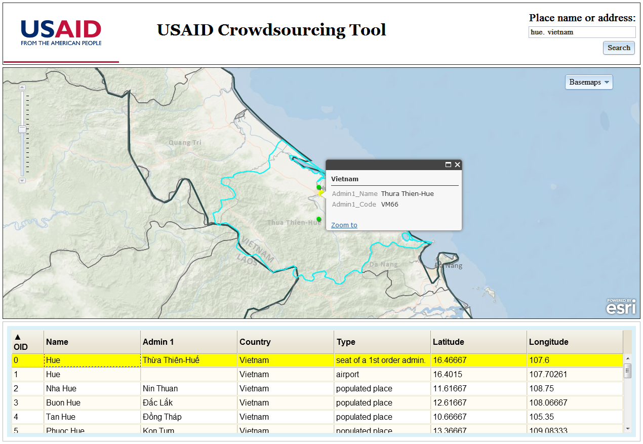
ESRI developed a tool just for the USAID crowdsourcing event to aid volunteers in their search for good location data matching the record.

esri hue

Geonames Tool:
geonames org detail


NGA Geonames Tool:
mil geonames

mil geo names hue

A summation: We’ve come a long way, baby. The White House noticed! But, “with miles to go before WE sleep.”


We also got noticed in the press. Below is a brief list:

  • USAID Impact Blog:  was actually a big deal because it’s infamously hard to get blog posts cleared on this!]
  • US State Department Dip Note
  • All Africa
  • DevEx
  • Wall Street Journal Market Watch
  • Reuters
  • Federal News Radio
  • Blog post by Woodrow Wilson Center Fellow, John Crowley
  • Original SBTF Blog post: sbtf-usaid-partnership-on-poverty-alleviation-and-smarter-development


Posted in Uncategorized | Tagged , , , , | 1 Comment

A Master’s Thesis on the Motivations Behind the SBTF

[Guest blog post by Evelyn Hichens, an SBTF volunteer who has just completed her Geography Msci course at the University Of Birmingham, UK. For her fourth year dissertation she decided to focus on quantifying the motivations behind the volunteers of Standby Taskforce. A powerpoint presentation of her MA thesis is available here.]

Hey Mapsters,

As you some of you may know, I’ve been carrying out research into the motivations behind the standbytaskforce.com for the last six months or so. I have had some great chats and have really enjoyed hearing about your experiences and motivations. I have previously done some research on crisis mapping but it mainly focused on the ‘for’ and ‘against’ of using crowdsourcing in a humanitarian setting. However, I have now realised that it is first important to understand the motivations behind the volunteers involved - without this information the movement could be prevented from moving forward. Not paying enough attention to volunteer motivations has been a criticism of previous Volunteer Geographic Information (VGI) studies.

So firstly for those who don’t know what my research is on, here is a quick overview of the methodology. I used the Volunteer Function Inventory to create a survey and to quantify the motivations of volunteers. In total 42 volunteers answered the survey – many thanks for all you who did! I also interviewed 13 volunteers, and four core members of the SBTF as well as four representatives from organisations that had previously activated the SBTF.

Just quick overview of some of my key findings…

Volunteers tend to join the SBTF as they have an interest in the field of crisis mapping/disaster response and they are curious to see what the SBTF does. The SBTF has widened the field for participation in disaster response. For the majority of volunteers I spoke to, their main motivation was their desire to help but a secondary motivation was also noted, the chance to learn new skills.

The volunteers are passionate about the work the SBTF is doing and this can be shown by one of my favourite quotes from my dissertation:

“[The SBTF] is an organisation of compassionate individuals who use a variety of skills, training and experience to provide humanitarian aid in crisis situations through online interactions. Some are professionals and others learn from scratch, but every person has an important role to play.”

Volunteers tend to exhibit similar understandings of the purpose of the SBTF whilst they do not share a clear understanding or necessarily have an awareness of the SBTF’s long term aims. Yet, somewhat controversially, this does not seem to be an issue. It has previously been mentioned that crowdsourcing initiatives require clear long term objectives and that the greater the motive alignment of the crowd, the more likely it is for volunteers to feel like a partner. Instead the key to the SBTF is ‘keeping the conversation alive’. Volunteers are attracted by the openness of the community; as the end goals are not set in stone, the volunteers have the opportunity to be part of its future. Volunteers are driving the initiative, rather than purely being an anonymous cog in a machine.

The profile analysis showed that 46 percent of the volunteers had not joined any teams. When volunteers join the SBTF they fill in a bio section, in which the question ‘What teams would you like to join?’ is filled in. However, just because volunteers have filled this in it does not mean they are a member of these teams. Volunteers who read this post I urge to to check that you have actually joined a team/s that you had filled in, as without this information the SBTF cannot have a clear understanding of its community’s skill-set.

As altruistic motivations prevail in the SBTF community, it is crucial that the volunteers are aware of what the outcome of their efforts will be and how their labours translate into helping people. During the interviews, two volunteers discussed how they required more information on the impact of the deployments to conclude whether they are actually helping people. The SBTF needs to ensure, where possible, to provide the volunteers with detailed information on the impact of their work. As well, before activating deployments, considering whether volunteer motivations will be met through their engagement. This may mean that volunteers will be less not motivated to volunteers for those deployments that are not in a crisis setting.

The SBTF answered the request of the Disaster 2.0 report for an effective interface between volunteers and traditional organisations in the field and this has been recognised and appreciated by the traditional organisations that have activated it. So far motivations for activating the SBTF have been experimental in nature, yet engagement has been positive and the SBTF are steadily becoming a valued member of the response community.

This study’s understanding of volunteer motivations should allow the SBTF to work towards enhancing volunteer retention, through both ensuring the volunteers know how they are helping people, and continuing volunteer skill development through training, simulations, and support throughout deployments. It hopes to catalyse further studies focusing on volunteer motivations in the field of crisis mapping; this field is rapidly expanding, and it is important volunteer motivations are understood so that the SBTF are aware of these and consider them in the management of the community.

Many thanks to all the volunteers that took part in the survey and to everyone I interviewed. I would be very interested to hear any of your comments so please feel free to get in contact.

Posted in Uncategorized | Tagged , , | Leave a comment

Harvard Humanitarian Initiative - (HSI) Simulation Exercise - An Appreciation

Our partners (HSI) had the tough work mucking about in the cold and wet weather. Our resulting map…

Thank you

“This past April 27-29 over 100 HSI program participants came together in a state forest just north of Boston, Massachusetts to participate in a simulation exercise designed to replicate a complex humanitarian crisis. For two and half days of unseasonable New England weather, participants worked in the rain and cold to respond to the needs of a (simulated) vulnerable population in need of immediate humanitarian assistance.”


Humanitarian Studies Initiative (HSI) Simulation Exercise

Posted in Uncategorized | Leave a comment